Photos from Indian Peaks Ski Trip: April 29th, 2001
Russ Detwiler (a post-doc in Civil Engineering) and I made our first
2001 back-country ski trip on April 29th. Our destination was the
summit of Mt. Toll in the Indian Peaks, along the Continental Divide west
of Boulder. We drove up the road towards Brainard Lake, and (as expected),
found the road closed half-way up. So we packed our gear and set
out on our bikes towards the trail head. Here's Russ getting ready
to see how a top-heavy bike handles.

We're not sure what all the other cars are doing here, since we only
saw two other skiiers all day. The road here is clear, but just around
the corner there are huge snow drifts that even a big plow couldn't get
through. The elevation here is probably around 9,500ft.
After a tough slog on the bikes (which involved many dismounts to push
the bikes through snow drifts or over black ice), we reached the Mitchell
Trailhead. Note the depth of the snow on the information signs.

After a brief hike through the woods, the Mitchell trail breaks out
into open tundra.

There is not much elevation gain for a while, but the deep snow is still
a bit of a challenge. Russ and I both break through the snow and
land in a stream at one point, soaking our boots. After a few hours
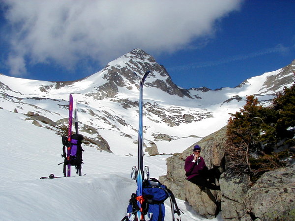
of hiking, we reach Blue Lake (still frozen and snow-covered), where we
break for lunch. The wind has been blowing all morning, so we find
some shelter behind some rocks. Mt. Toll is the peak in the distance.
The left side is the skiable face.
After eating about six of my eight sandwiches, we head back out.
The wind is dying down, and the summit looks clear! Two skiiers are
ahead of us, and they have made some nice footprints in the snow to walk
in.
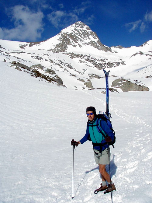
Now the going gets tough, as the elevation increases and the pitch of
the slope increases. Here I am pausing, hoping that the fabled "oxygen
inversion" will set in. The row of peaks in the background all form
(along with Mt. Toll) the Continental Divide. None of the mountains
here hit 14,000 feet, but most come quite close.

Here I am at the Summit (elevation around 13,000 feet). Time for
some more snacks. We are waiting for the snow to soften a little
bit more before we descend.

Here is a panorama taken from the summit. The panorama is actually
six images that have been digitally stitched together. You are looking
down both sides of the Continental Divide. Russ is hungry.
Note that you may need to scroll your screen to see the whole image.

O.K. It's time to go!!!!! By the time we are ready to descend, the wind
has almost stopped, and the temperature has risen to around 50 degrees.

Here is Russ headed down the initial pitch, which is not very steep.
The mild slope gives you time to get a few turns in before it gets steep.

O.K. Now it's getting steep. The snow is fantastic!!!!

We were able to ski the entire way back to our bicycles, since the snowcover
is still quite extensive.